
Background
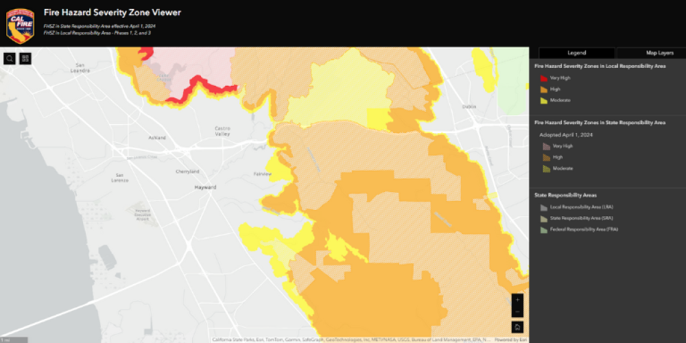
The new maps, released last month by the California State Fire Marshal, cover areas under the jurisdiction of all local fire departments (called Local Responsibility Areas, or LRAs, and assign comparative levels of varying fire-hazard severity based on climate and topography.
Under state law, cities and other local governmental agencies are required to adopt or incorporate the new hazard designations of moderate, high and very high into local ordinances that inform and guide local land-use planning, code enforcement and wildfire risk mitigation strategies.
For more information, review the Fire Hazard Severity Zones Local Responsibility Area Factsheet.
Impacts to Homeowners Insurance
The new fire hazard severity maps are unlikely to affect homeowner insurance prices in California, as insurers already use this information and other data in their pricing models.
California Department of Insurance has provided the following frequently asked questions documents:
- Insurance and CAL FIRE Hazard Severity Zone Map (English)
- Insurance and CAL FIRE Hazard Severity Zone Map (Spanish)
Find Your Property's Fire Hazard Severity Zone Classification
Click the search icon () to enter your address into the Fire Hazard Severity Zone Viewer below to learn more about your property's Fire Hazard Zone Classification.
Upcoming Meetings
There are no new meetings scheduled at this time.
Questions?
For questions about Fire Hazard Severity Zone (FHSZ) maps (not public comments), please email: firesafehfd@hayward-ca.gov