


Announcing and inviting feedback on new fire-hazard severity maps
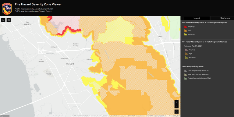
The Hayward Fire Department and Fairview Fire Protection District want to make residents and property owners aware of and invite feedback on new Fire-Hazard Severity Maps covering the City of Hayward and Fairview Fire Protection District.
The new maps, released last month by the California State Fire Marshal, cover areas under the jurisdiction of all local fire departments (called Local Responsibility Areas, or LRAs, and assign comparative levels of varying fire-hazard severity based on climate and topography.
Under state law, cities and other local governmental agencies are required to adopt or incorporate the new hazard designations of moderate, high and very high into local ordinances that inform and guide local land-use planning, code enforcement and wildfire risk mitigation strategies.
The new fire-hazard severity maps are not expected to impact the pricing of homeowner insurance in California, because the underlying information is already built into modeling used by the insurance industry to set coverage premiums.
For more information, including links to the new interactive fire-hazard safety maps and a survey to provide public comment, visit the Local Responsibility Areas Fire Hazard Severity Maps page here on the City of Hayward website.